Bitte ändert euer Passwort!
Im März 2026 wurde das Forum gehackt. Dabei hatten die Angreifer Zugriff auf die Datenbank und somit Zugriff auf eure Passwörter. Auch wenn das Forum kein Passwort im Klartext speichert, können die Angreifer eure Passwörter knacken. Bitte ändert daher dringend euer Passwort für das Forum. Solltet ihr das gleiche Passwort auch an anderer Stelle verwenden, ändert es bitte unbedingt an allen Stellen!
how to get flight data on maps
- wimapon
- Autor
- Offline
- Junior Mitglied
-

- Beiträge: 28
- Thanks: 1
how to get flight data on maps
19 Jan. 2017 18:24we use gpsvisualzer program to look at the flight-path on a google map.
This works perfect, but we have seen somewhere in the past a program
that also put the flight-speed and altitude at the side of the map...
The program followed the plane from place to place as a movie.
Where can i find that program??
Wim Apon and Jan Bakker
Bitte Anmelden oder Registrieren um der Konversation beizutreten.
- NicoS
-
- Offline
- Platinum Mitglied
-

- Beiträge: 489
- Thanks: 146
Re: how to get flight data on maps
19 Jan. 2017 19:41www.jetimodel.com/en/JETI-Studio-2/
I think you are Dutch. Right???
Bitte Anmelden oder Registrieren um der Konversation beizutreten.
- wimapon
- Autor
- Offline
- Junior Mitglied
-
- Beiträge: 28
- Thanks: 1
Re: how to get flight data on maps
20 Jan. 2017 08:08So, do i understand it right... make a flight, put the data in the sender, and then copy the data to a pc and then start jetistudio in that Pc?
Wim
Bitte Anmelden oder Registrieren um der Konversation beizutreten.
- NicoS
-
- Offline
- Platinum Mitglied
-
- Beiträge: 489
- Thanks: 146
Re: how to get flight data on maps
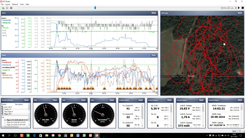
20 Jan. 2017 09:50 - 20 Jan. 2017 10:13The transmitter must be set to the required purpose. The best you can reading the manual, the chapter "Sensors / logging Setup".
Nice pictures as below are then possible.
The synthesizer in the transmitter can speak values, for example, height and speed. This can be periodically, for example every 30 seconds and / or after the flip of a switch.
Please note that the GPS altitude is not so accurate and the GPS speed is ground speed and not air speed.
Bitte Anmelden oder Registrieren um der Konversation beizutreten.
- wimapon
- Autor
- Offline
- Junior Mitglied
-
- Beiträge: 28
- Thanks: 1
Re: how to get flight data on maps
20 Jan. 2017 14:08That is exactly what we are looking for...
Where can i find the manual, the chapter "Sensors / logging Setup?
thanks !
Wim
Bitte Anmelden oder Registrieren um der Konversation beizutreten.
- NicoS
-
- Offline
- Platinum Mitglied
-
- Beiträge: 489
- Thanks: 146
Re: how to get flight data on maps
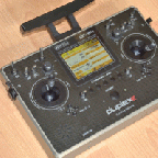
20 Jan. 2017 14:49 - 20 Jan. 2017 15:22www.jetimodel.com/en/katalog/Transmitters/@produkt/DC-16/
Bitte Anmelden oder Registrieren um der Konversation beizutreten.